

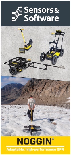
Synopsis GPR case histories, studies, and examples
The following is a synopsis of GPR case studies followed by a PDF of the studies provided by Sensors & Software. The following is intended to guide and give users ideas about the wide application of ground penetrating radar as well as provide insight into how users tackled tough projects. If you do not see a case study similar to your current project and would like some guidance, feel free to contact us for suggestions as to how GPR or other geophysical methods will suit your project.
GPR Case Studies for Agriculture and Forestry
Agricultural Drainage

Agricultural drainage systems have existed as long as humans have farmed. Often made of plastic piping, clay tiles, metal, or even stone filed trenches, these waterways can be difficult to locate. Further, many fields contain nutrient-rich electrically conductive clay that distorts GPR signals, making locating anomalies very difficult. The USDA and researchers at Ohio State University carried out a study to see whether a highly detailed GPR survey could overcome a poor environment.
Golf Green Management
Managing a golf green is difficult. It requires both the right amount drainage so the grass doesn’t die yet isn’t too wet for play. Therefore, the terrain is carefully engineered with surface contouring and specific soils such as sand. The Loxahatchee golf course decided to use a Noggin 1000 to locate drainage pipes and channels under a distressed green to access problems and make repairs.
GPR Case Studies for Archeology
Locating Foundations of a Brick Factory
An archeology class at Hocking College in southeastern Ohio decided to use a Noggin 500 to discover local history at a roadside park at the old Nelsonville Brick Company location. The area was one of the largest brick producers and Nelsonville Brick Company produced millions of bricks during its tenure in the late 1800s. The park contains three existing kilns, but the students were able to conduct GPR over three grids and locate the foundation of additional kilns.
Finding Graves in a Cemeteries
For those managing old cemeteries, knowing the location of where people are buried is important business. Over the years, markers get moved, mis-positioned, lost, or in some cases, one large memorial possesses the names of several members of a plot with no positional data. Further, often infants, young children, and “undesirables” from years ago were buried without markers. This case study from Alabama exhibits how one cemetery used a Noggin 250 to locate burial sites without disturbing the soil.
Irish Mound Archeology
Evaluating a historical site presents many problems. Excavation can be costly and time consuming while also putting artifacts at risk of damage. In 1994, a demonstration using a 100 MHz pulseEKKO IV GPR was deployed in step mode to explore the Rathcroghan mound, believed to be the burial site for Queen Maud of Ireland.
Historic Road Construction
Danish archaeologists determined to find the location of a historic viking road used a pulseEKKO IV system in step mode. Because the road material had pushed into peaty soil and overgrown, its exact location was unknown.
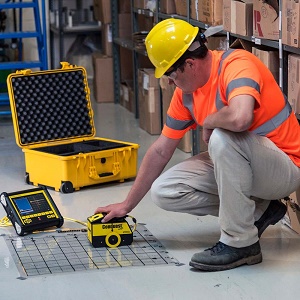
GPR Case Studies for Concrete Scanning
Correlating Line Scan Case Study
A GPR contractor was brought in to scan a slab of concrete at a condominium renovation because new pipe lines needed to be routed. Upon surveying in line scan mode with a Conquest system, the GPR contractor noted a vast amount of congestion, making the results difficult to analyze with certainty. Therefore, to collect the best results possible, the contractor set up a grid so cross sections could be compiled into plan view depth slices, providing more accurate and detailed results at a site where line scan mode results were difficult to interpret.
Locate Radiant Heating Tubes
A contractor was asked to core several 3 inch holes; however, the floor possessed in-floor heating. Any damage to the heating system would put the project completely over budget. Therefore, it was determined that the tubes must be located before the coring could be done by running a grid survey over each coring location.
GPR Maps Post Tension Cables
A mall decided that with its growing business that it needed to renovate the parking garage to add more parking. However, because ownership had changed several times over the years, no details about the garage’s construction existed. In order to determine if the structure could handle an addition and to locate post tension cables when expanding the garage, the builders hired a GPR consultant to find post tension cables.
GPR Case Studies for Geotech and Environmental
Saltwater Infiltration
GPR is becoming more popular in coastal areas. Obviously, salinity will greatly affect GPR response. While performing an archeological survey looking for a Roman road in the UK, scientists observed the characteristic boundary location between fresh water and salt water. This case can be helpful in determining how GPR will work in coastal areas whether there are concerns about saline contamination of drinking water or the user just wants to use GPR for the exploration of mineral deposits in beach sand.
GPR for Bathymetry and and Sub Bottom Profiling
Hydrologists and engineers often need to determine accurate water depth measurements in shallow freshwater lakes and rivers. Smaller, weed infested lakes and rivers make it difficult for large ships with acoustic equipment to navigate. Many freshwater bodies of water will readily accept a GPR signal when equipment is placed in the bottom of non-conductive raft or boat. The compact nature of GPR in conjunction with GPS make a good combination of instruments to map water depth, soft sediment, and rock boundaries. Surveys can be conducted through vessels such as a rubber raft, wooden boat, or on ice in a sled.
Mapping Underground Fuel Storage Tanks at a Local Gas Station
GPR is often used for environmental concerns such as locating underground storage tanks. Often, the exact perimeter or location of these storage tanks is unknown. This is a common problem when a gas station has been around for a long time or the land is sold that used to be a filling station. In this GPR case study, an operator used a Noggin 250 to map underground storage tanks and processed the data with EKKO Project software.
GPR Case Studies for Ice & Snow
Glacier Girl – Snow & Ice Scanning

In 1942, an aircraft being ferried from the United States to England was forced to crash land in Greenland. The crew was rescued but the plane was abandoned and subsequently buried among the snow and ice. Using historic photos and the knowledge of the ice movements, an area of investigation was determined. Over several expeditions, the buried aircraft was found with a pulseEKKO GPR and ultimately recovered.
GPR & Arctic Oil Exploration
Oil exploration in the Arctic often requires seismic surveys that put large amounts of energy into the subsurface via large trucks with vibrators. In order to ensure that surveys can be safely conducted, the operators need to know that the ice thickness is sufficient for these trucks to drive on and put seismic energy into the subsurface via vibration. Below is example of surveying ice thickness with a Noggin system.
Snow to Water
In Northern and elevated regions, melting snow pack affects the water table that influences drinking water, irrigation, recreation, and hydro electric power generation. For this reason, scientists are interested in both the depth of the snow pack and its concentration of water. Using GPR and measuring the velocity changes, scientists are able to measure the different total depths of each layer of snow to estimate water volumes.
Glacier Mapping
Areas with glaciers depend on these deposits of freshwater for drinking, irrigation, and hydro electric power generation. Estimating the volume of water can be a difficult task. Further, the volume of a glacier continually grows and recedes. GPR in conjunction with GPS can help determine the size and volume of subsurface ice sheets.
GPR Case Studies for Locating Pipes and Cables
Subsurface Utility Engineering or SUE for Water Installation
A city in California needed to install a new water line across an intersection. Not knowing the exact location of the preexisting utilities in the area, the city decided to perform a subsurface investigation using an LMX200. Three parallel lines were collected and real time field interpretations were made. The collected data was saved along with GPS coordinates for future projects.
Locating a Storm Water Sewer with GPR
Horizontal Directional Drilling is commonly used as a fast, environmental friendly, and cost effective method of installing utilities. The drilling guidance system relies on knowing the depth and location of all utilities. So when a small sink hole occurred after a major rainstorm, the drilling crew was perplexed. Upon further investigation, an unknown, non-metallic sewer line was discovered that was punctured by drilling. Later in the project when the drilling crew needed to install more utilities down the street, GPR was employed to locate the unexpected sewer line.
Environmental Assessment
Environmental assessments often require borehole drilling. However, before drilling can occur, the site needs to be cleared. In this example, a gas station sale required such assessment. Using a Noggin 250 SmartCart, the operator set up a grid and successfully located the location of all subsurface features and provided an area for the borehole operators to safely drill.
Underground Utility Mapping

New York City needed to differentiate between PVC and cast iron pipes at a busy intersection. Construction design and planning called for the completion of a Level B Subsurface Utility Engineering or SUE survey for mapping potential conflicts with existing utilities. Often PVC and cast iron pipes are difficult to find with traditional utility locating methods. Therefore, leadership decided to use a Noggin 250, creating a 8 m by 23 m rectangular grid, and producing depth slices with the post processing software as well as making infield markings to locate and mark the utilities.
Verifying Gas Line Location
Locating buried gas lines is an important safety measure. Hence, most municipalities require landowners to call their local “digger’s hotline” before performing any work that needs excavation or digging. The following is a comparison between a GPR unit and a traditional EM (electromagnetic) utility locating device.
GPR for Buried Utility Locating
GPR can be a very helpful method for finding subsurface utilities, particularly in areas where utilities are non-metallic or EM noise makes traditional locating impossible. The following case studies discusses different methodologies such as mark and locate as you go vs mapping the area and creating plots with depth slices. It also discusses instrumentation, configuration choices, and antenna frequencies.
GPR Case Studies for Mining & Quarrying
GPR for Kimberlites
Diamond exploration often requires locating kimberlites and then analyzing these kimberlites for its diamond potential. These mining operations will use several geophysical methods other than GPR as well as ground sampling to find these kimberlites and other trace minerals associated with diamonds. Once these kimberlites are located, GPR is often employed for detailed mapping of the geologic structure to optimize core drilling locations for diamond assay samples.
GPR for Lateritic Nickel
Tropical weathering of ultramafic rocks creates Lateritic Nickel deposits. Nickel is leached from the rock, resulting in high concentrations of nickel in the overburden. Deposit areas located within the overburden vertical profile normally have an upper soft sediment-like (limonitic) zone over a saprolitic zone (nickel rich serpentonite boulders encased in limonite) over unweathered host rock. To determine the mining potential of an area, miners often evaluate the thickness of the two zones using GPR.
GPR Case Studies for Police & Security
GPR Guides Exhumation
In 1968, a girl and her sister-in-law went missing in Pennsylvania. Several months later, a young woman was found murdered and dumped off Route 82 in a patch of poison ivy. Authorities thought it may be one of the missing women but positive identification wasn’t possible. Approximately, eight months later, another girl with matching sandals to the first woman was located five miles away but again authorities were unable to be identify the victim. Both women were buried in unmarked graves. Years later, at the request of the family and the advent of DNA, police used GPR to locate the graves, exhume the bodies, and identify the missing women using DNA.
Murder in Sweden
A family feud between a younger and an older family member involving money resulted in a disappearance of an elder family member. At first, it was assumed that the elder man was abducted. However the younger family member confessed to the murder after being on the lamb from authorities for over a year. After receiving a description of where the homicide victim was buried from the confession, authorities still could not locate a precise location to excavate. With the use of a Noggin 500, authorities where able to create a detailed map and recover the body.
GPR Case Studies for Roads & Bridges
Road Pavement Forensics
Subsurface degradation under roads causes unforeseen and expensive future repairs. In order to be proactive and prevent costly remediation to a busy highway, GPR was employed to survey a multi-lane highway with asphalt over concrete.
Bridge Deck Evaluation
Inspecting bridges for concrete delamination and corrosion of reinforcing steel is important for the safety of everyone that travels. GPR has been proven to be an effective method of inspection and the ASTM # D6087 standard describes the principles for using GPR for this purpose. In this example, the changes in signal amplitude show deterioration indicative of deck delamination.